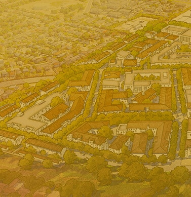
The Design Code for VICINIA is developed around the Transect, a system of land classifications described in The Lexicon of the New Urbanism, which incorporates a fine-grained network of lot distinctions. These characteristics follow the natural internal structure of an traditional neighborhood and serve to create the structure of the community of VICINIA. This structure is expressed as three urban sectors: Urban Center (T5), General Urban zone (T4) and Reserve/Preserve.
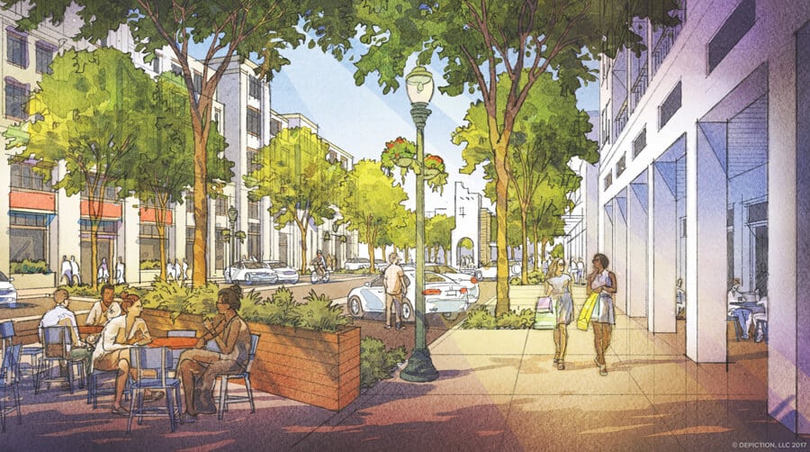
The Urban Center Zone (T5) is the focus of the neighborhood’s civic buildings and social activity. It incorporates retail, workplaces, and more dense residential units, and it connects directly to other parts of the neighborhood through a network of carefully designed vehicular and pedestrian thoroughfares. As such, it is the densest graining of land subdivision in the neighborhood. The streets are generally designed with formalized on-street parking characterized by avenues and main streets. Buildings placed either at or near the right-of-way line further reinforce the streets edge and public character.
The General Urban Zone (T4) is that element of the Transect which focuses principally on residential use with a minimum of other potential uses. Streets and boulevards generally characterize the thoroughfare makeup within the General Urban Zone.

The spreadsheet on the following pages forms a block-by-block analysis of VICINIA. Each block, identified in the diagram to the left, corresponds to a row in the adjacent spreadsheet. Among other information, the spreadsheet provides an overall block area, building footprint area, an approximate residential unit count, and an estimate for the available retail area.

VICINIA is about a great new place. A place envisioned as sensitive to its distinctive indigenous Texas context. A place that encourages mobility without dependence solely on the automobile. A place inhabited by a diverse social, economic, and age varied citizenry. A place to be experienced. A place that relies on a new paradigm, built essentially from scratch.
The village is circumscribed by six-character districts, each with its own distinct architecture and character defined in a distinct color palette, materials, smells, sounds, and interactions.

1
The Entry Sequence role is that of greeting visitors to VICINIA at existing adjacent arterials Potranco Road, Military Drive, and the extension of Ingram. As gateways, it is important to announce the interest-creating activity that enhances an engaging experience to all where residents and visitors informally meet. The uses along this sequence will include commercial, retail, and living of all sorts, primarily on the ground floor. It is, however, likely that a complete mix of uses will occur above the street. Each district should reflect uniqueness. In particular, this district may identify with a series of architectural elements including towers, arcades, landscaping that enhances the function of the urban space, along with outdoor engagement such as seating kiosks, etc. As such, it will share some of the highest densities experienced in VICINIA.
2
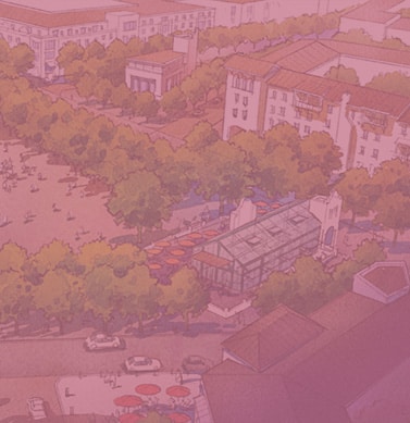
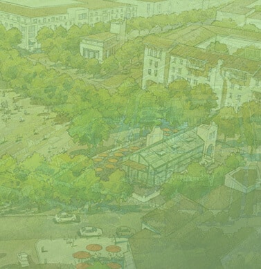
The Plaza district is the heart of VICINIA where everything comes and goes. It is the social corridor with similar densities to the Entry District. It will be the liveliest and most engaging in all of VICINIA, situated within a five-minute walk of the entire village where transit systems will embark and disembark 24-7. With all of these offerings, it is the most appropriate place for the positioning of civic uses.
3
Of all the predevelopment conditions presented by the site, perhaps the most significant is the drainage way located on the north and west of VICINIA. In its place will be a bioswale with trails, bridges, engaging structures, fountains, and of course indigenous plantings which will add context to VICINIA. Views toward this naturalist swale will help to celebrate the uniqueness of San Antonio and benefit the residents of VICINIA
4
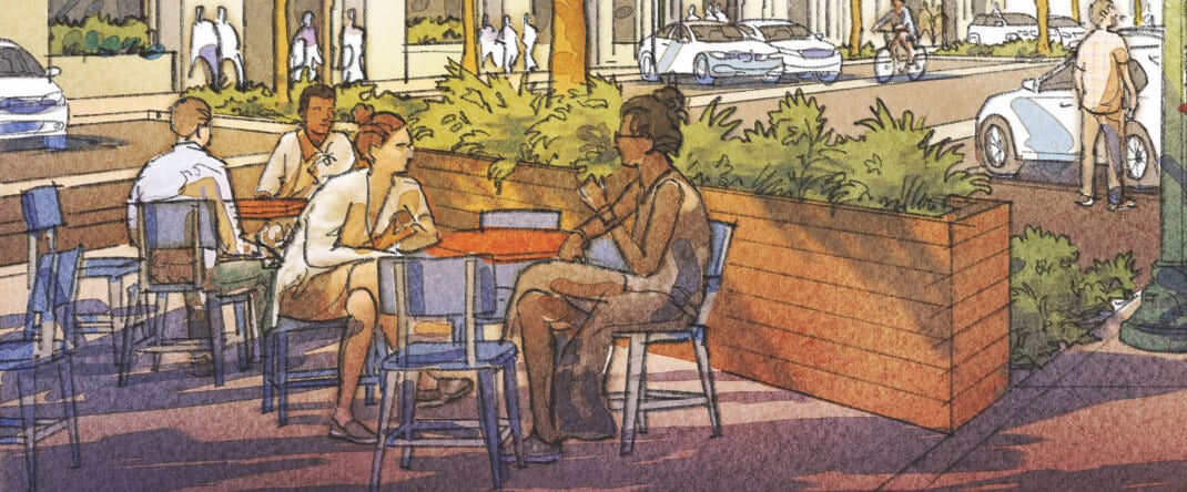
Breaking down blocks into more sensitive scaled urban areas is done in part by the introduction of a series of passages referred to here as “Mews”. Historically, mews were used as service corridors and later converted into rich spines of special lofts, shops and restaurants. These have become some of the best places in older settlements. In VICINIA these are strictly pedestrian and intended to support artisan activities. The at-grade promenade is designed to support, in addition to living; dining, vending, and artist engagement—a place intimately scaled, reinforcing vistas both from outside in, and inside out.
5
The Fine Grained Multiuse District is intended to accommodate the general housing for VICINIA, and as such will include a product for all levels of the social spectrum represented by the richness of various price points, sensitively mixed. The mix will include various types of parks for use by all ages. The scale will begin the transition from the edges of lower buildings into the much more dense centers encouraged in the Plaza and Entry Districts.
6
To be responsive to the land adjacent to VICINIA, the Edge District intentionally positions along its edge housing of similar scale. With townhouses, and mansion condos characterizing the building types, the Edge district is the finest grained neighborhood space offered in VICINIA, with building heights lowered to 2 to 2.5 stories. While still physically connected to all aspects of VICINIA through a network of pedestrian friendly streets, passages, and parks, its character is intentionally more informal and quaint.
Based on the T4 and T5 context classifications, transportation facilities are planned to help achieve the mixed-use, walkable patterns essential to the TOD community vision. The function of these streets goes beyond the typical suburban arterial and collector streets, which emphasize vehicle mobility and land access, respectively. Both mobility and access are vital to all streets in the VICINIA TOD.
Mobility for all modes is the fundamental design assumption. Pedestrian, bicycle, and transit modes are as vital as motor vehicle movement. Generous sidewalks, narrow lanes, curbside parking, street trees and build-to lines for structures are all important to achieving greater walkability, primarily through vehicular speed management. Although the Boulevards and Commercial Streets are larger than the Streets, Yield Streets and Lanes, all streets are almost equal in their functions of providing mobility and access.
Access to all land uses from the edge of each street is also important. Parallel parking on most street edges allows drivers to park, and, within a reasonable walk, reach the building doors connecting them to their destinations. Pedestrians, given a much greater advantage in the network, can move more easily and safely on multiple paths and gain essential access to buildings from the sidewalks that line all streets.

Access to all land uses from the edge of each street is also important. Parallel parking on most street edges allows drivers to park, and, within a reasonable walk, reach the building doors connecting them to their destinations. Pedestrians, given a much greater advantage in the network, can move more easily and safely on multiple paths and gain essential access to buildings from the sidewalks that line all streets.
